Issue
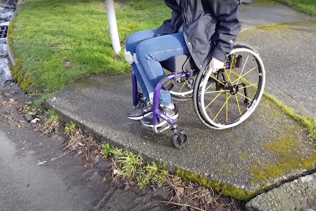
Accessible pedestrian infrastructure, such as connected sidewalks and safe crossings of busy streets are necessary for people to walk or roll to transit or nearby destinations. However, the absence of accurate mapping depicting preferred walking and rolling routes, along with the associated accessibility conditions, pose a barrier for individuals with mobility challenges. This lack of information leaves them hesitant to walk or roll to access transit or essential services, uncertain of potential obstacles that may hinder their trip.
Residents at Health Through Housing (HTH) facilities have diverse mobility needs, some have a difficult time accessing transit and reaching places for their essential daily needs. Many HTH sites were former hotels or motels and do not have adequate pedestrian access.
Spark
Evaluate how accessible technology can improve routing and trip planning for residents of King County’s HTH program, and help identify locations for future sidewalk infrastructure improvements.
The Taskar Center for Accessible Technology at the University of Washington developed digital tools that both empower community members to contribute to a more complete mapping database of sidewalk gaps through OpenSidewalks, and with AccessMap Multimodal, guide people using routes that work for their abilities and needs.
Overview
Continuing the ongoing collaboration between the Taskar Center for Accessible Technology and King County Metro, the HTH Pedestrian Accessibility Mapping project will provide valuable data on the accessibility of HTH sites by mapping the walking and rolling routes – and barriers along those routes – between HTH sites, nearby transit stops, and other destinations.
In the near-term, data will be used to produce walking and rolling maps,and enhance UW’s existing pedestrian route planning services for HTH sites to educate and empower residents to walk and roll for short trips to transit and nearby destinations.
Longer term, King County Metro’s Connecting to Transit team will work to incorporate identified access improvements into their partnership and funding pursuits to support implementation of walking and rolling improvements that connect HTH sites to transit.
Together, these outcomes support both UW’s and King County’s goals of enhancing the local community, sustainability, and equity through continued innovation and partnership.
The Pedestrian Accessibility Mapping project will progress through the completion of the following core tasks:
- Use satellite technology to compile a set of Geographic Information System (GIS) mapping data for areas within a 10-minute walk of HTH locations
- Capture current pedestrian infrastructure conditions within the OpenSidewalks data standard
- Construct cloud infrastructure that facilitates the use of data by AccessMap and Walksheds, two accessibility-focused map tools
- Analyze the dataset to assess existing pedestrian route accessibility conditions
- Conduct field visits to validate the original dataset
- Conduct analysis to identify candidate areas for accessibility-focused sidewalk upgrades and investment
- Develop a database of scoped pedestrian improvement projects
Innovation
By leveraging accessible technology and data-collection methods, King County Metro’s collaboration with the Taskar Center for Accessible Technology at the University of Washington will inform HTH residents of the accessibility of nearby pedestrian infrastructure. In addition, a dataset of accessibility information will jumpstart future walkway accessibility enhancement projects.
Impact
A review of the return on investment from this project’s final product will look to answer several key evaluation questions:
- Is the data collected helpful and actionable?
- Is this a cost-effective mechanism for collecting this type of data?
- Can this project be replicated for future sites or in a different setting?
- Is the final product useful to related programs, such as Connecting to Transit and Metro Access?
- In what ways can King County Metro further leverage the compiled data?
Team
This work is support by King County Metro.
