Issue
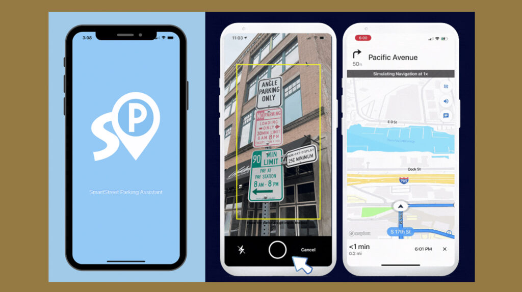
Wayfinding apps for delivery drivers and people who are trying to park their vehicle do not have access to real-time curbside restrictions, which leads to extended travel time due to circling to find an appropriate spot. Cities are also trying to make the best use of curb space to improve street use and safety, but may not have a digital picture of parking and commercial load zones.
Spark
Artificial intelligence (AI) can be used to detect signs and catalogue parking sign images into a database for mapping and wayfinding. Various cameras, such as a dash-mounted, or traffic camera can be used to capture the streetscape can help build an inventory for city curbside management and consumer vehicle trip planning.
Overview
The project will build a smart curbside parking management system by using machine learning and internet of things (IoT) technologies. The goal is to develop new technologies that correctly read and locate the curbside parking signs from the street videos taken by dashcams and to detect and track the parked vehicles and open parking spaces from roadside deployed cameras. The information will be available to local agencies and app users.
Innovation
UW research professor Wei Cheng developed and tested an artificial intelligence (AI) model to identify parking signs and curb management features, such as commercial load zones from simple camera feeds like a dashboard camera or a traffic camera. This next phase of research will address the technical hurdles to fine tune the AI models for sign detection, sign tracking, and sign text recognition. In addition to sign detection, the video odometry technology, map, and video GPS footage will be catalogue exact locations in a curbside parking inventory database.
The AI models will be enhanced for lane detection and vehicle detection, parking occupancy tracking using machine learning based parked vehicles detection and tracking technologies. The anticipated technical results include a series of AI models and algorithms, a curbside parking rule database, and a system for curbside parking inventory management.
Impact
Better curbside data for wayfinding helps street users through a hands-free mobile app find the right area for parking and freight delivery quicker without circling unnecessarily, which contributes to localized congestion at busy peak periods, and additional tailpipe emissions. Partner cities would have a digital inventory of their parking restrictions for street management.
Team
This work is supported by a Partnerships for Innovation Technology Translation grant from the National Science Foundation, AiWaysion, and the Mobility Innovation Center at the University of Washington.
Academic Department
Faculty Leadership
Wei Cheng, Ph.D.
Research Areas
- HCI & Security: Utilize nano biomatric sensors such as muscle sensors, eye trackers, and taste sensors for security and control applications.
- Smart Transportation: AI for automatic street parking sign reading, navigation, and parking.
- Emergent Acoustic Communication: Acoustic based solutions for localization and communication with mobile devices.
Contributors
- Wei Sun
- Bart Treece


